History
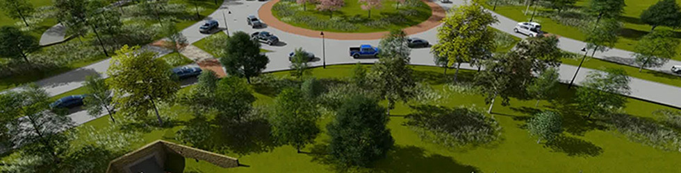
The Texas Heritage Parkway (“THP”) is a 6.4-mile, 4-lane boulevard roadway, from I-10 to 2100 feet south of FM1093, running alongside various developments, through Waller and Fort Bend Counties, with portions in the city limits and extraterritorial jurisdiction of the Cities of Katy and Fulshear. Unlike any other road in the Houston area, THP is constructed to include roundabouts instead of signalized intersections, a landscaped esplanade, and a regional multi-use trail with pedestrian crossing tunnels. The design for the project was based on extensive research on the safety and enhanced traffic flow of roundabouts in comparison to signalized intersections and the transportation needs in the area, with an emphasis on aesthetics and pedestrian-friendly mobility.
The projected cost for the project is $55M (not including landscaping), to be shared among Fort Bend County (30%), the City of Fulshear (10%), the City of Katy (10%), and private developers (50%).
The Texas Heritage Parkway Improvement District (“THPID”) is managing initial construction of THP and responsible for maintaining the landscaping/trail system and enforcing deed restrictions along most of the corridor after the project is complete. THPID is a municipal management district—a political subdivision created over a limited area to provide road and other public improvements and services—governed by a 5-member board appointed by Fort Bend County. THPID has the power to tax within its boundaries and impose assessments to apportion the costs of certain improvements or maintenance and will be reimbursing certain landowners from defined area bonds. In essence, THPID is a vehicle for long- and short-term funding and management of the project.
District Map
